I don't have a name for this journey just yet, but I think I may have solved what for me was a rather large dilemma. Getting from Philadelphia to Boston in the most direct way means traveling trough a densely crowded corridor passing Newark, New York and Long Island. An area I've been to several times, each time only briefly and I have zero desire to be back even if just passing through, but especially passing through on a motorcycle. Witnessing that insanity from the back of an Uber was plenty of adventure for me. Due to the fact I am not on a clock for this trip, I am afforded the luxury of taking the long way when desired or in my opinion with this case, necessary. So I have decided to head in a more northwesterly direction up toward Scranton and Binghamton; then a hard right turn to Albany. The extra miles will allow me to see some prettier country, ride better roads and provides an excuse to visit Cooperstown, where I can buy me some peanuts and crackerjacks,
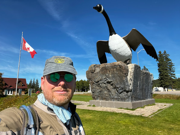
So...I'd say it's time to start planning again but it's way beyond that. I believe I am approaching this next trip later than I should be. Be that here nor there, It's still time. I had planned to circumnavigate North America this year, counterclockwise, to the four corners of the USA and a bit of Canada. Learning from my last trip however, I know now that I don't want to have such long days in the saddle and not enough time to see my surroundings. So I have decided to ride an abbreviated version of my four corners ride. I'm now going to do an east coast trip up to Newfoundland, and then ride the Canadian side of the great lakes to Wright, Minnesota, where I can relax on the family land and get some fishing in. The current thought process has me renting a U-Haul to get the bike back to FLA, without much fanfare.
The basic route for the trip has been plotted out, what I need now though is a title. I've been kicking around the idea of calling it "The Viking Run" based on a planned stop at L'Anse aux Meadows and the Viking tie in to the Land of 10,000 Lakes.
I left Helen, GA this morning and after about an hour or so was out of the mountains and heading in to the farms and lowlands of south Georgia, Two hours of today's riding was on pure highways, I16 and I95 south. Tomorrow I will cross over the state line and back in to Florida and this trip will be in the books.
So I'll use tonight's entry to talk about the two other star players that made this trip possible.
First, would be the bike that has performed flawlessly touring me around the south and carving up curves and hairpins on some of the best motorcycle roads in the country. My 2021 BMW F900XR. When we pull in that drive tomorrow afternoon it will have earned a well deserved break,
And second would be my wife Rachel who has been overly understanding and supportive of this trip. She put up with months and nights of planning and family research all to have me depart on the day of our wedding anniversary. This trip would not have been possible without her support.
This morning I woke up and prepped the bike for the Tail of the Dragon. There's a lot to be said for a road that has signs at the beginning that read "Extreme Danger" and "Caution: Dangerous Crash Area Ahead". I've wanted to ride the Dragon since I first heard of it, and even lived cloe enough that it should have been doable on a regular weekend. For what ever reason I had for not coming to the Tennessee/North Carolina boarder and try to battle the famed lizard; today there would be no excuse.
The mountains of North Carolina, Tennessee, Virginia and Kentucky are chock full of roads with names Like "The Moonshiner", "The Diamondback" and "Copperhead Road" and now you can find twisty blacktop tracks known as the "Head of the Dragon", "Claw of the Dragon", "Back of the Dragon" and the amazing road I took a few days ago, "The Dragon Slayer"; but they all must pay homage to The Tail of the Dragon. An 11 mile run that crosses the border between Tennessee and North Carolina on U.S. Route 129.
The Tail of the Dragon, part 1
The Tail of the Dragon, part 2
So, yeah, it's a beast! It was an incredible ride and while I did have to pull over to let a few guys on sport bikes get by and a couple of Fiat 500 Abarth's, I also had to pass a few bikes traveling slower than myself as well. I guess if I had to describe this road in one word, it would be respect. You have to respect those riders who can carve up this piece of asphalt in short order and you damn sure better respect the road itself. There's a saying on the Dragon's Tail, "Watch the road, not the scenery", because this road will bite you.
Photos of bikers biting it.
The Tree of Shame
Dragon Slayer
I left the dragon's lair behind and made way for the town of Helen, Georgia with one last epic ride through a picture perfect mountain setting, following the turns and switchbacks along the Nantahala River.
The Nantahala River
I made it to Helen, GA around 2:30, my shortest daily ride of this trip and spent the afternoon walking the town with it's Bavarian themed shops where every day is Oktoberfest. Tomorrow I will put these wonderful mountain roads behind me and start to make my way to the flat farm lands of south Georgia and the curves are few and far between. Two more days and I'll be home.
This morning I got up and did some laundry before hitting the road. It was sunny and warm and a big departure from being soaked to the bone yesterday. I would be a great ride today. I checked in to the campground yesterday by phone from the bike and asked for a cabin versus trying to pitch a tent when I was already soaked and cold. That made for the right choice as the cabin had all of the needed amenities and was spacious and dry. I wound up getting a late start, leaving the camp at 11AM and heading west towards Harlan, Kentucky. I found Harlon to be an old city dropped in a valley surrounded by tall hills and I couldn't help but imagine how it must have bustled in the 30's, 40's and 50's.
Harlan, KY
Leaving Harlan, I would have a three hour ride in front of me to my next location, the Dragon City Resort, strategically placed at the starting line of the Tail of the Dragon, I had a hot but dry run almost all the way to Dragon City. When I was about five minutes out it started to sprinkle and then drizzle a bit more as I neared my layover for the night. Upon arrival got of the bike in a light rain and unloaded my gear in to the room before the bottom dropped out. I hope I have that same luck tomorrow when I make my first ever ride on one of North Americas premium motorcycle rides.
I stayed at an Air BnB in Portsmouth, Ohio last night, just across the river from Kentucky. Nice place, comfortable and relaxing. At some point in the middle of the night a loud thunderstorm rolled in and I had a sneaking suspicion it would continue through this morning. And it did. I stayed indoors and rearranged gear and let the rain clear to what seemed the best it would. I hit the road at eleven under grey damp skies and trekked 8 miles north to Lucasville, Ohio and Houston Holler. My dad spent his teenage years growing up in Huber Heights, OH, just outside of Dayton. He used to tell me however about being a kid in Houston Holler, which he always seemed to think was in Kentucky, when it is actually across the state line in Ohio. It was the idea of finding Houston Holler that generated the idea for this trip. Stories of my Great grandfather as a constable in Ashland/Greenup and old paperwork I have trying to move with my dad as an infant from Newfoundland to Greenup started me looking in to the Potter name around that area and delving further in to the internet to find the history I have to this point.
Houston Hollow Rd. sign (bad screen grab)
Houston Holler is not so much of a place anymore as it is a road running through it. As I road it today I imagined it as either dirt or rough finished tar at best when my dad's family lived back there. The road running through there now is quiet nice and winds it's way through areas reminiscent of a state park. I knew I needed to try and beat the rain so rather than ride the entire length of Houston Hollow Rd. I turned around and put the setting sun to my right, southward bound and towards home. There will be no more stops on this trip tracing my family name. From this point, it is all about the ride.
And boy did that ride suck. I no further made it to Greenup and the rain began, and once it began it didn't stop. For the next two and a half hours I would ride in various precipitation, be it light drizzle to driving rain and wind. My destination was Appalachia, Virginia where I wanted to pick up route 160, known in the two wheel world as "the Dragon Slayer". I really don't mind riding in any form of rain, but I was getting dejected at the thought of riding the Dragon Slayer in the rain. As luck would have it, when I came over a ridge in to Wise, VA the rain cleared and the sun actually came out, with ten miles left to go to Appalachia.
I found the entrance to the Dragon Slayer just outside of down and started to make my run as the clouds began to roll in. The Dragon Slayer is a 20 mile run between Appalachia, Virginia and Lynch, Kentucky. In that span of 20 miles there are 226 curves and hairpins and a littoral pinnacle point where you cross over the top of Black Mountain, Kentucky's highest peak at 4,145 feet. aside from less than a half dozen oncoming vehicles, I would be the only person on the Dragon Slayer today. And did I mention? They put down a brand new asphalt top two weeks ago! When I pulled in to Lynch, I knew I had ridden the best motorcycle road ever.
So tonight, I'm in a cabin I rented just outside of Harlan, Kentucky, a town that in its coal mining heyday had a population over 5,000 and carries less than 1500 today.
I wasn't able to upload any content last night, so there will be two entries today. I published yesterdays a few minutes ago.
Today was a great day! But let's go back a bit to last night. I got in to Breaks Interstate Park a bit late due to running all over the back roads of Virginia and Kentucky looking for Abraham Potter and George Washington Potter's grave markers, neither of which could I find. The G.W. Potter one really had me bummed out.
It started raining around 4AM and I had to get up and throw the rain fly over the tent. Just a drizzle really so it wasn't any big deal, all my equipment was in the tent with me so it didn't affect this mornings prep.
Leaving the park I took a moment to head out to the Stateline Overlook and take in the Grand Canyon of the South.
View from the Stateline Overlook at Breaks Interstate Park
The low area behind me is known as Potter's Flats.
So last night, I did a little more internet sleuth work and thought I may have stumbled on a lead for another burial site for G. W. Potter. I would be heading past the location, somewhat, on my way out of Elkhorn City so it seemed worth a shot.
What it would mean though was a two mile hike in to the forest on an old logging trail. So outside of Elkhorn I located a road, it was more like a paved sidewalk called the Right Fork of Beaver Creek Rd. which dead ended at a dirt path. I found three ladies sitting on the front porch of the last house on the road and asked if there was a cemetery up that dirt trail. Their reply, "Yep, the ol' Potter cemetery", Watson, I think we are on to something. They allowed me to park in their driveway and in to the woods I went.
Trail to Potter Cemetery
My first view of Potter Cemetery
It took about 20 minutes to hike the trail, and then a clearing appeared to my left and low and behold, there it was. A perfectly manicured and fenced in little cemetery in the middle of nowhere. I walked up and let myself through the gate and found roughly 30 markers, several that were not Potters and a handful marked unknown. But then one marker stood out, the one with the old Kentucky flag and CSA Cross in front of it. It was the stone for my Great great grandfather...George Washington Potter.
George Washington Potter, 1823-1925
G. W. P. and the Confederate Cross
A 20 minute hike back out of the woods in 90 degree weather and I was on the mount and back off to Elkhorn City and the the old city cemetery. The Elkhorn City Cemetery is on a steep, and I mean steep hill overlooking the town and people have been laid to rest there for what must be centuries.
Elkhorn City Cemetery, all of the near grave markers are Potter's
I located a couple of G. W.'s brothers, Andrew and Henry.
A picture of Andrew
Potter (left)
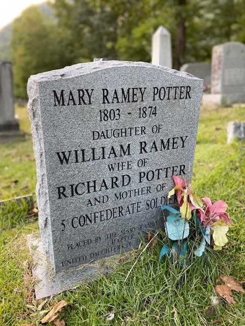
And while it was great to locate those markers, the reason I was here was to find the resting place of Richard Potter's wife, Mary "Tennie" Ramey Potter.
Mary "Teenie" Ramey Potter
Now, this part is a stretch, but it is fun. Remember that singer, Patty Loveless, whom I used a line from one of her songs to title this trip? Well she was from Elkhorn City and her real name is Ramey!!!
So...whatever, I'm going to say I'm related to Patty Loveless. Oh and, they named the main drag through town after her.
Patty Loveless Drive.
I headed northwest out of Elkhorn City on my way to Geenup, KY. This would put me on Kentucky's Route 23. The road thought by the miners and farmers would take them to a better life up north where there were jobs aplenty and less chance of dying a mile below the surface. I would imagine that's how the rest of my family, from my Great Grandfather, also Richard and my Grandfather Virgil would end up leaving Greenup and finding jobs in the auto plants in Ohio. But on my way to Greenup, I had to make one more stop, in a little out of the way place just outside of Van Lear, where I found the cabin, on the hill in Butcher Holler.
The birthplace of Loretta Lynn, the Coal Miner's Daughter.
Greenup, Kentucky
Tomorrow I'll head north about 20 miles to last place on my trek to find my roots; and the genesis for this entire trip, Houston Holler.